Great Gable and Green Gable from Honister Hause –Sunday June 3rd– Week 3

Easy to follow paths – a Lakeland classic

The Wasdale region of the Lake District is quite unfamiliar to me. It generally takes about two and a half hours to get here, more if you choose to take on Hardnott Pass then it’s more like three hours. It’s home to the Scafell massive of course and Great Gable was our first ascent and would be a marker for how we would fare on the next few walks leading upto and attack on Scafell Pike itself in August.

Leading anyone onto fells of such magnitude as Green and Great Gable should and did cause me some concern. Just to acknowledge the responsibility that comes with it and that while anyone who cares to come along does so at their own risk I can’t help feeling a little bit anxious. The weather of course is first to consider and given that summer still hasn’t started properly all eyes were on the forecast for days before. It was looking like a mixed bag weather wise but generally it looked like it would be dry but cloudy.  The mountain forecast alluded to early fog in the south clearing from the north and so figured Skiddaw as a second option. By Sunday morning I decided that Great Gable was still on so we left the grey skies of the north east behind fingers crossed for better in the west.

Very steep path from Honister Hause to Grey Knotts

Today we rustled up a little crew formed from previous companions. Later riser, bed headed Cherry Cheeks/Hip Hop heppers AKA Paul, made the last shout from Abs who leavered him form his pit with a phone call at 8am. Abs of course back from the dead since missing Blencathra was buzzin to be back on the fells again. Lesley was keen to come along but her participation in this event was still hanging in the balance since she was struck down with a bout of sickness that couldn’t be explained, so she came a long for the ride with the small people Jack and Em.

This outing was going to be special because we were all about to S.M.A.S.H our altitude records. I was especially excited for Jack and Emily because they would do so on the same day as me, meaning that we had something to share and remember as a joint achievement. Furthermore Jack would have bagged another 4 Wainwrights taking his total to 30. Not bad for a 9 year old who not that bothered about walking, though with every successful S.M.A.S.H he takes on a greater appreciation for what we do an a Sunday each month.

We arrived at the Slate Mine on Honister Pass familiar to those that made the ground breaking walk of Haystacks and Fleetwith Pike in March. Squashed between Dale Head and Grey Knotts it’s alive now not only for those wanting to take home a special piece of the lakes in the form of some real green slate, but also people looking for thrills outdoors. I’d read about the recent planning applications to establish a 1.2km zip wire here which would run from Black Star on Fleetwith Pike to the car park at the slate mine making it the longest in Europe. The BMC (British Mountaineering Council) formally rejected the development in May 2011 argued it to be inappropriate in an area of such tranquility. What it does have though is a Via Ferreta which is Italian for the iron way. A system of cables and iron rungs attached to the rock face historically used to move soldiers through the Alps. It gives ordinary people the experience of rock climbing without any mountaineering experience to get close to the rock at heights they would never previously thought possible.http://www.honister.com/via_ferrata_at_honister.asp. Of course the plans sparked a huge battle of words between those who believe the Lake District is a national park that should remain an oasis of peace and tranquility and those who want to make it the adventure capital of Britain and develop it into a playground for thrill seekers and extreme activities. It’s a tough one. Personally I can see it from both sides. I tend to object when I imagine the hordes of cars passing through small villages like Seathwaite and Buttermere. The infrastructure to support visitors would be too intrusive and would certainly loose that unspoiled aroma that Buttermere has managed to hold onto unlike it’s Windermere relation. Though like many others that appreciate the outdoors and the lakes as a place to visit then I do want access to it. Wether I’m walking, mountain biking or hanging from a rock by a wire then I don’t want to be told I’m spoiling the tranquility. But I do understand it if Jack is issued with a dispersal order.

After almost heading off in reverse we tracked back and began the steep ascent to Grey Knotts a stepped thigh busting climb among  the crags and crevices that make up this side of Honister’s hause. Jack quickly began to boil up complaining he was too warm. We discovered under his jacket he was layered up to the eye balls thanks to his mother who has a tendency to over dress the small people. Removing a mid shirt Jack was on his way up.

Ascending Grey Knotts

We used the fence line to track a straight line across the contours then out of nowhere a fellow sporting a red sash and running short cross our path and hooked himself over the boundary blowing a horn as he went. This was odd and saw him run aimlessly into the distance. Then just minutes after another guy did the same but he was looking less comfortable and not wearing a red sash, in pursuit of the previous guy. It was evident something was going on and I hadn’t a clue what it was but it sounded familiar if only for the horn that was just like the ones huntsmen use on a fox hunt.

Gaps began to extend between us with Abs setting a healthy pace while I hung back with Jack and Emily. We clambered though the rock formations and arrived at Grey Knotts as a stiff wind gathered strength now we were in the open. Views opened up all around. Behind was Dale head with it’s obvious tall cairn though it was just a tiny pin from here and Haystacks and High Stile on our right and Kirk Fell straight ahead. You could go on spotting peaks all day from here.

Emily’s a spring chicken and she’s having a ball and Paul’s an extra from Oliver.

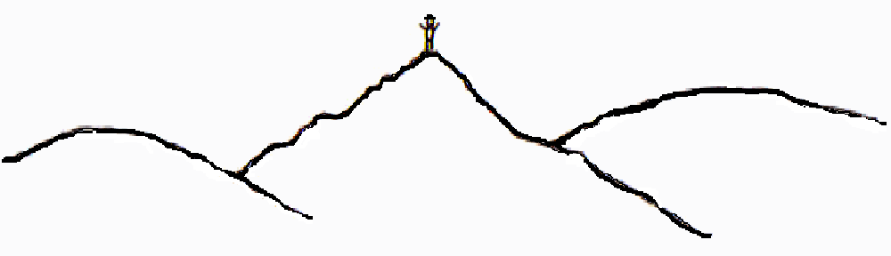
A little person taking a rest on a bundle of toothpicks. Great Gable behind with a cloud top.

We picked out our next goal and Brandreth but it’s unimpressive against a backdrop of much mightier mountains. With the wind firmly behind us we set off and cock a leg back over the ruined fence line to follow a wide path strewn with boulders punctuated good cairns. Small pools and tarns meant that the going was easing. The next Wainwright, Brandreth would probably be the easiest peak we’ve Smashed yet as we cruised onto it not entirely sure we were even on it. There are a number of cairns around here so asked sput nick to point us to the correct pile of stones. Brandreth forms a triangular plan that falls away gently to the north to Grey Knotts and Honister. To the west it drops to Ennerdale and east it falls very steeply to Gillcoombe amd Seathwaite. Thus Brandreth is the only fell that feeds the three lakes of Derwent, Buttermere and Ennerdale.  It’s a large plateaux and barely feels like a ridge walk to Green Gable.

From Brandreth – Left to right – Pillar – Ennerdale Water- Haystacks and High Stile – Buttermere and Emily.

Excitement mounted as Green and Great Gable dominated the view ahead. Green Gable

Jack climbs Green Gable from Gillercomb Head. A fine view of Ennerdale Valley and the River Liza

looked like a challenge while Great Gable was daunting since it held it’s cloud cap from the time we could see it. No other peak did, not even those on the Sca Fell range, and this seemed to reinforce it’s height. We took off easily downwards toward Gillercomb Head making up the path as we went through the massive stones that gathered evermore dense. We all agreed to walk as far as the foot of Green Gable and shelter from the growing wind to take out lunch and fuel up for the climbs ahead.  Jack and Emily nested among the stones and passed around a fine platter of chocolate muffins and turkey sandwiches. Abs took a back seat and was quietly breathing the air while Heppers had relieved a passing walker of his lighter for a lunch time tab to complete his Artful Dodger ensemble, all he need now was my accent and the part was his. We filled our cake holes, leave the shelter (and maybe one of Emily’s pink gloves). We make straight for the tidy peak via an equally tidy path that slices through the grass banks of Green Gable.

Gillercomb Head and Green Gable and Great Gable

Green Gable – SMASHed!

Green Gable is an outstanding viewpoint in every direction. The view down to Ennerdale and Buttermere holds much interest. There’s lots to take in. Separated by Haystacks so familiar to us since we were there on sunny Sunday in March. Behind us we could still see Dale Head and Robinson, Maiden More now from this height. Great Gable is so close, so enormous it can just about fits in your eyes.

Gable Crag from Green Gable

To the south east below Great End the tarns of Styhead and above, Sprinkling Tarn. On the horizon, The Langdale Pikes of Harrison Stickle and Pike of Stickle.

The was no doubt about our position as far as Emily could tell. I’d traced her finger over the map on Saturday night stopping at Windy Gap. Today it was worthy of it’s name. Emily smiled and shouted against the power of the wind in the col between Green and Great Gable. “This must be windy Gap!”

Broad Crag, Sca Fell Pike and Sca Fell as seen from the Windy Gap

The fun part started now on the climb or scramble if you wanted too up Great Gable itself. We crossed and zig zagged our way through the loose rock. A wrong foot here could end a walk as sand coloured boulders rolled and slipped under the boots, it felt better to get a hold here and there. The passing places are narrow. Waiting to let other walkers by was safer than trying to pick another line. Jack and Emily always enjoy this kind of climbing, they seem to crawl over the rock but often end up making their own route up simply because they cannot see the path being that bit smaller, they need guiding back to the trail.

The summit is a massive boulder field, a rounded summit with a number of cairns indicating the way up, or the way down. We climb onto the summit behind the memorial plaque set on the summit rock commemorating those members of the Fell and Rock Climbing Club who died in the First World War. I hadn’t told Abs about the view from here and just before we arrived I set him for the surprise view which was that over Wasdale and Wast Water. It didn’t fail take your breath away. This view is just stunning and considered a favourite of many walkers that love the fells. So many other peaks can be seen grouped all around. No wonder this place is often chosen to scatter the ashes of loved ones. I point out to my friends that we stand on the summit of the mountain that sits at the centre of Britain’s favourite view if seen from the far end of Wast Water. The silhouette of the Wasdale range made of Yewbarrow, Great Gable and Lingmell is depicted in the emblem of the Lake District National Park.

Time to bring out the thermos. It’s getting colder now as we shelter behind the cairn out of wind and pass around the binoculars to survey the fells around, notably spending most of the time spotting other walkers ascending Scafell Pike. There appeared to be no one on the Pike. The shelter was easy to make out. But on closer inspection and a slight tweak of focus the shelter was actually mobbed by walkers, changing shape as people bustled about on the summit. Also seen were scores of walkers in single file heading up too. It was like Fawcett Street up there, (or Piccadilly Circus depending on your upbringing). Abs avoided the offer of tea, not wanting to foment a toilet break. Jack messed on with the GPS forcing a new altitude record beyond the official 899 metres by standing high on the cairn with his arm stretched high it clocked 900 meters. I fear he’ll be bringing a set of steps on the next outing. He was highly amused. We polished off the remains of our bait and sat back and watched the cloud roll in behind us. The view began to fade and signaled the best time to descend but not without a SMASH peak photo, though it was devoid of any scenery, replaced with the grey cap we’d seen Great Gable wear all day. Jack offered to do the honours as we stood battered against the moist wind. Just before leaving though the cloud lifted ever so slightly and grabbed this shot of the small people who I have to say am so incredibly proud of. They really have made this day so fun. I now marvel at how at ease they are outdoor in such openness. They entertain us by entertaining themselves. It’s great to share their effort with them and listen to them pointing out the next peaks they want to climb. Scafell Pike for them now looks very achievable with Skiddaw and Helvellyn to SMASH in July they should be set for a successful assault on England’s highest.  So big up the small people!

Brother and Sister – Jack 9 and Emily 8 years on a very windy Great Gable summit.

Descending Great Gable. Yewbarrow and Wastwater make the backdrop.

We set away down the north west face of this pyramidical fell into a bombed maze of rock and car sized boulders overlooking Kirk Fell. Steeply down, holding the stone and checking our feet. It’s tricky. Lead by Jack and Emily we descend below the cloud line the view begins to open up again for a sharper look at Wasdale. Jack and Em begin their usual teasing of the older members of the crew by wondering out loud about what was holding us up.

I don’t mind being teased far taking it easy but there’s a time and place for speed and this particular descent needed a little patience as Jack soon found when he wrong footed tumbled off the narrow path. He rolled over lengthways a couple of times fortunately the sides were stable enough that he went no further. We all gasped. At first we thought he would keep going. He was ok but a bit shaken. Shocked I think from the idea he had just fallen off a mountain. His leg hurt near and his hip, apart from that he was ok. It could have been worse if he’d knocked his head or something. I checked him over and  he began to cry, he knew he had been a little too excited, sliding down on his backside as sometimes he and Emily do when it turns steep. I think his back pack served as some protection too cause I’m sure he fell onto some rock embedded into the ground. I was a little cross with him but it wasn’t a time for being cross, he needed a quiet word of warning about taking his time and not to get over excited. A reality check for Jack and reminder of what can happen when you loose concentration for moment. I explained that when accidents happen it’s the cold that is the real danger if you cannot move you get cold quickly out here and it can take a long time to get you off the mountain. We had a hug and held hands for while until the trail eased a little and made down to Mosses trod which we would follow to Drum House.

Paul in Stone Cove

We got caught up in the game of Hare and Hounds and this time we quizzed a guy about what was going on. In essence he was just playing tig. He was a senior looking fellow with stork like legs. He surveyed the fell all around but set sights on a man with a red sash. He was the hare and this old “hound” we were with pretended to be with us doing his best to disguised himself as a fell walker so he could get closer the hare. We carried on walking and he backed up the fell. We talked to another younger couple of hounds and they explained there are four hares and twenty hounds. The hares are generally made up of professional runners, cross country runners, tri-athletes, people of that persuasion. The game is a tradition that takes place every Whitsun and has done since 1898 and is essentially a manhunt that history tells was really a woman hunt. She was known as Black Sall, she was a notorious smuggler in the 17th century, so the story goes, who was torn to pieces by dogs. They had chased her over the fell as she tried to escape with her booty. She had been smuggling plumbago (graphite) from Seathwaite mines – a then precious commodity used in the manufacture of cannonballs. Today there’s a bothy called Black Sail Hut just below Haystacks.

Mosses trod named after another smuggler.

Leaving Great Gable along Mosses Trod

The trail dips into Ennerdale slightly to give good views of Haystacks and Black Tarn before turning right to Drum House. Whilst Paul pondered the merits of running a calculated probability model in order to increase one chances of winning the lottery, he let out a yelp of excruciating pain. He went over and hit the deck grabbing his ankle. What a fright! But he’d just twisted it and got up and carried on almost as if nothing had happened. 20 minutes later he did it again. This time we weren’t nearly as concerned despite the same cries of pain.

Black Tarn and Buttermere

The walk was a gentle stroll from now on and the mood was ever relaxed but for Abs and Jack quizzing each other on the worlds geology and national flags. Anything to pass away the slow descent to Honister knowing full well a big mug of tea was waiting at the slate mine tea shop. Abs lead the way down with Emily then Jack and Paul and myself holding back and holding my bladder. I should have taken heed to Abs’s advise on Great Gable.

Chatting about small matters.

Honister Slate Mine in miniature


Walk Route Summary:– Honister Pass, Honister Hause, Grey Knotts, Brandreth, Green Gable, Windy Gap, Great Gable, Westmorland Cairn, Beck Head, Beckhead Tarn, Moses’ Trod, Wainwright’s Coast to Coast Walk, Honister Pass.Vital Statistics for this Walk

  • Length/Distance: 9.00km (5.75 miles)
  • Total Ascent: 731m (2340ft)
  • Allow at least: 4.50hrs
  • Walk Grade: 


Blencathra from Threlkeld – near Keswick – Sunday 6th May

Blencathra’s ‘other’ ridge

For anyone who visits the Lake District from the North East over England’s spine the Pennines via the A66 will most likely face the mass wall of mountain with the distinctive ‘Saddleback’ shape. Blencathra is one the most accessible of mountains, at least if your hail from over our way. I can recall (before I ever walked on any fell) the times I passed by this range so close to the motor way. It runs so close you have to crane your

Hall’s Fell Ridge to Hall’s Fell Top

neck to see the top from the car. It’s imposing and to me back then looked far from accessible. In fact I don’t believe I had a notion that anyone would walk on it. I mean how could you, more over, why would you want to? But I think even then as someone who had no comprehension of the pleasure it gives to take a path up to the top of a mountain, I still wondered what it would be like to stand on it. The weather concerned me. It always looked grim and unwelcoming as if it was saying, ‘you can have a go, but you need to know what you are getting into.’ I’m not an experienced climber, mountaineer by any stretch of the imagination but I look at these peaks now and just want to be at the top, now with more of a sense of curiosity. I wonder what you can see from that one?

Those early musings must have had some sort of impact on me. This will be my fourth visit to Blencathra having always ascended from Scales. One failed attempt at Sharp edge with my wife’s uncle Ray trying to ignore the fact I had a viral infection that had me stopping after every 10 steps, you can imagine what peering over the Edge felt like. I don’t really do heights as it is. Ray swore blind we needed ropes to scramble the last hands on section onto Atkinson Pike. He talked me out of it, we retreated back to Scales Tarn and ascended via the common route to Hall’s Top.

I wanted to make this walk a little different. One where we could get our hands on a mountain and figured the way up should be a scramble via the other ridge on the face of Blencathra. Hall’s Fell ridge is a prominent rib that has some excellent options for anyone looking for taster for scrambling.

Today was blighted only by the absence of friends and family. The week had mowed down some of our sturdy companions. Abs, with a chest infection and Emily with a cold. Nicole also worse for ware, threw a sicky. Lesley of course stay home with Emily which was a shame as I was looking forward to helping Lesley get her own back at Blencathra after I once misguided her first attempt on any fell, throwing her in the deep end. We bailed about two-thirds of the way up and didn’t speak for bit afterwards. But after her stirling effort on Haystacks and Fleetwith I figured she was better conditioned now for a crack at Big Blen. But after all the hype she missed out. 

Anth, was super enthusiastic as ever and  he’s clearly excited about the prospect of SMASHing higher peaks. They appeal to him, because Scafell Pike looms in August on the diary. Blencathra will wet his proverbial big peak whistle I think.

For Jack, it’s just another day out with his dad and whoever else might like a look out. It’ll be a chance for him to SMASH his personal altitude record. I think his highest prior to today was the Old Man of Coniston, 803 meters which he SMASHed when he was 5 years old. At nearly 10 he can’t remember much of it now. He prefers not to.

From Thelkeld we start out through the village to Gategill and pick up the footpath taking us directly onto Hall’s Fell Ridge. In no time at all the gloves were on. Can you believe it started to snow? I wanted to say it’s was sleet because it can’t snow in May surely? But it was snow. No chance of it settling on the ground, that wasn’t any concern but what was would be the state of things to come at height. Looking skyward we could see white clouds of snow moving in from Keswick and another one just below Knowe Crag to the left of the ridge. I wouldn’t describe it as threatening; but more bizarre. The temperature was just 9° when we left the car and the sky was breaking up and the lambs seemed joyful enough in the fields and generally it was still pleasant weather.

I decided to take the sting out of the first 150 meters by taking a faint track diagonally across the fell and then cut back onto the main path. The height gained quickly offering views west of Derwent Water and to the South-east, Great Mell Fell. We spread some yards between us making our own way onto the ridge stopping to watch the reaction of sheep to Jacks wooly hat. Sheep often loose sight of their little ones too and need to get by anyone in the way.

Once on the ridge, the grassy fell gave way to a loose slate chipped path flanked with bare rock crags. We aimed at the false summits on the ridge and marked them out for a sit down. I figured halfway would be a good time to take a break. The experience so far was already so different from any other ascents on the S.M.A.S.H calendar. From this standpoint the shape of the peak is more pinnacle than the approach from Scales. Alfred Wainwright gave more pages to Blencathra than any other Lakeland peak in his guide books. I think he makes reference to seven ascents of Blencathra giving considerable praise to the Hall’s Fell route.

Anth enjoying a wide open space over looking Clough Head with Threlkeld quarry below.

From here on the ridge narrows and the stone crevasses signal the way forward.  Once on the ridge the temptation for me at least was to stay on it, despite knowing the path is just a few meters below. I invited Jack and Anth to take the hands on alternative. Before long we are all coiling ourselves and springing to the next ledge, flexing and grappling with the mountain and hefting our way upwards.  As we moved on we each take our individual view of the ridge seeking out the most interesting lines.

Jack getting a hold of the mountain in the snow!

The ridge was busy today with most choosing to make their descent on Hall’s Fell Ridge. A committee of unlikely looking fellas were having a meeting on the ridge and eyeballing the best way down across some slippery slab sections.

The only way is Up!

After 2 hours and 10 minutes we pop directly onto Hall’s Fell Top, the principle summit point of Blencathra. There’s none of that over the brow and walk 100 yards to the trig,  it’s there as soon as you peer over the last of the ridge to find a small sorry-looking cairn and a concrete ring in the ground marking the summit. There were a few walkers on the summit and asked one lone guy if he would take our photo. Jack has now bagged his 25th Wainwright at 868 meters, so well done Jack. He was modest as usual about his latest achievement. I wanted to show Jack and Anth Scales Tarn and Sharp Edge. We turned right dropping down toward Tarn Crags off the path to find a stone to sit on. The view north from here is dominated by the rounded face of Bannerdale Crags with Bowscale Fell to the left. The east has Souther Fell and the A66.

Sharp Edge and Scales Tarn. With Bannerdale and Bowscale Fell behind.

It’s deadly quiet though and we sat to try to hear the conversations of those down below at Scales Tarn beginning their ascent via Sharp Edge, regarded as not fit for walkers. You need a head for heights, which I don’t and besides in this changing weather it’s smooth and sharp edges are best avoided in my opinion. The deep bowl shape holds sound in and makes it easy hear others talking that would otherwise not be heard at such distance.

We picked ourselves up and returned to Halls Fell top to join the South East track to Gategill Top and onto Knowe Crags. We neared the edge to get a giddy view down one of the many gullies to witness snow blowing from below us, carried by the wind tracing the side of Blencathra.

On Stern Blencathra’s perilous height

The winds are tyrannous and strong:

And flashing forth unsteady light

From stern Blencathra’s skiey height,

As loud the torrent throng!                       Samuel Taylor Coleridge

The snow was merely a shower and passed over leaving a white muslin like veiled scene. It was a surreal view like someone had been messing with the contrast setting. From the foreground through to the mountains of Skiddaw, Latrigg, High Rigg, the Newlands and Clough Head had their own shade of grey. You could make out Great Gable and Sca Fell too on the skyline.

Tewet Tarn in the foreground – Thirlmere and Derwent Water – You can just make out Sca Fell in the distance.

“That’s snow right there lad.”

With each meter lost in height we gained a clearer view of the path ahead down a zig-zag trail. It’s slow and hard on the knees. But as the path leveled (slightly) we sat down on the long grass as the snow gave way to sunshine we finished our lunch and took out the binoculars. We could spy out some walkers on High Rigg and into the model town of Keswick.

The conversation continued to be dominated between Jack and Anth since Jack heard mention of Derwent prompting him to recount every detail of his time spent at Derwent Hill, the outdoor adventure retreat for school kids. As it’s funded by Sunderland Council, a lot of adults from the north-east can remember their tales of outdoor malarkey with their school-mates. Anth had a chance to immerse himself in nostalgic memories with Jack confirming nothing had changed and everything was just as Anth remembered about thirteen years ago. Every swing, splash and jump was relived in vivid detail. Jack is looking forward to going back in October to learn more crazy songs about a materialistic bird with a yellow bill.

Stepping over Blease Gill

We cut back into the ingress on a buffed track to Blease Gill and right into the wood. Threlkeld is a pretty little village with well-kept houses made from the local quarry. There are more pubs than you can shake a stick at too. The sun was out for good now and the perils of snow far gone.

The Horse and Farriers looks like a good setting for a pot of Earl Grey from Twinnings. It was by Anth’s standards a fine cuppa made all the better by taking it outdoors to chat about the day against a perfect Lakeland back drop. After nearly 6 miles this walk crams in everything you could ask for from a day on the fells. Strenuous walking to bust the quads and calf muscles, a scramble for beginners, massive views to try out your peak spotting skills and the obligatory changing Lakeland weather experience. Which ever way you prefer to scale Blencathra it will please anyone with the slightest appreciation for getting out on the fells.

Clicky here: Vital Statistics for this Walk

Walk Route Summary:-Threlkeld, Gategill Farm, Hall’s Fell, Hall’s Fell Ridge, Blencathra Or Saddleback (Hallsfell Top), Gategill Fell Top, Knowe Crags (Blease Fell),Threlkeld.

  • Walk Grade: 

Ashness Bridge & Walla Crag – Keswick – Saturday 21st Jan


S.M.A.S.H. Get Pasted again on Keswick Classic 

January heralds the first walk of 2012 for the S.M.A.S.H. team and this time we go back to Keswick to bag that little Wainwright overlooking the town. Walla Crag is another of those much loved walks that proves you don’t have to get to the dizzy heights of the big summits of Skiddaw or Blencathra and the Helvellyn’s to really appreciate the beauty that surrounds.  I was here in the summer of 2011 when Jack and I picked up Walla Crag on the way to Bleaberry Fell and High Seat for our first wild camp. The scene this time would like very different in the bleakness of January.

S.M.A.S.H. were very pleased to welcome on board Umar. Abs’s younger and equally charming brother sporting the same dark locks and shiny beard it promised to be a good day if only for the company. So what weather would January 2012 serve up. Well one thing was certain, changeable and lots of water all around and the previous days rain would race down off the mountain gullies into Derwent Water.

The three of us eventually found each other in the darkness of the EDF car park desperate to get the journey started as early as possible. The rain was well set in and the outlook was a dreak looking kind of day however the forecast for Keswick was suggesting a mix of showers and sunshine but very high winds from the North West. We arrived at the Headlands Car park in Keswick around 09:20 and layered up for a walk that was one of two halves. Starting out along the shore of Derwent heading south to find Ashness Bridge and then climb North East towards Walla Crag.

Going soft

We all figured we may as well put on the water proof trousers now rather than battle with them in the wind. The last two walks we attempted to put trousers on you’d think we were trying to fly them rather than wear them. We picked up the clear footpath from the Borrowdale Road which lead down toward the lake shore into the edge of Great Wood on a rooty single track that squeezed us against the road and then against the shore line.The rock being wet forced one or two pre steps before really set your foot down just in case of a slip and an early bath.  I remarked I was already the number one suspect to take a fall as I didn’t even make my own stairs on Friday without braying my knee so hard it made me dance about on the landing for a while.  I’ll start wearing my boots at home more often I think. The view across to Catbells was very murky, dull and grey you could breath the moisture in the air. Derwent Water looked choppy, a lone pleasure boat was out obviously pleasure can still be found if just to see the mountains from the lake in complete solitude. I can appreciate that.

Still, we made it back onto the Borrowdale Road again after hopping over the small stone wall at Barrow Bay and crossed over to join the lane climbing steady we began to warm up we took off our hats. White water falling from the Falcon Crag, (popular with climbers) and Brown Knotts one must always remark on the sound. We all agreed that it’s the best sound for anyone looking to de-stress and for me nothing captures natures sound better. In no time at all we arrived at picturesque Ashness Bridge. Turn back and you see one of finest views in Lakeland. One that has graced postcards and calenders for years.

A couple of Hobbits from the Shire

Ashness Bridge is a quaint little pack horse bridge wide enough for just one car. It wouldn’t look out of place on the Shire as Umar rightly observed. Barrow Beck run underneath, over masses of  smoothed stone creating dramatic falls and of course that wonderful sound. We stood and admired the view down to Derwent and to Skiddaw and took up suitable posing positions for the family album. Then Umar took up the lens duty and began snapping franticly as Abs and I did our best to ‘work the camera’ as Umar was clearly get a kick from directing us for best effect.

The Brothers Beyoned – Skiddaw and Derwent Water

Now it was time to get a bit of altitude. A walk without it just would be right in the S.M.A.S.H. diary so we turned back to pick up the footpath and traverse the fells below Brown Knotts through the gate with the high tech rock on a  chain closing device. Since we  were not so far from the Bob Graham memorial it would only right we should come by a fell runner. They never fail to make you feel comparatively lame as we stood to take a breath, pretending we were just admiring the view as he jogged by in running shorts and waist bag. “He’ll catch his death.”

As we gained height the wind began to bite and gain strength. Now with nothing in it way, the crags we walked above were acting as a wind accelerator as the wind rams into the steep fell-side it has to go over the op and comes at you with huge force. Umar already looking like a ninja in his face buff tightened his hood and Abs battened down everything, refusing to look towards the wind incase his windows blew in. Umar started jumping up with his arms out hoping to be blown to some far flung destination. Then went chasing his headgear across the rough heather. The wind was immense. The view was ever changing, the clouds racing from the Newlands Valley across the lake in seconds. I lead us on towards Lady’s Rake shouldering the gale.

Not all water falls!

The falls near Cat Gill were a sign of how windy it was as the water was lifted up and back on itself spraying us as we made up to the last press up onto Walla Crag.

Walla Crag is not so much of a summit but view point made of a great baldy stone plateaux with plenty of room to run around. In the sunnier months this place would be filled with family’s on day trips from Keswick. Everyone and his frog would be up here. Today we had the place to ourselves.

I made straight for the outward view over Derwent  across to Cat Bells and behind the snow capped summit of Grisedale Pike.

Catbells, Maiden Moor and Grisedale Pike from Walla Crag

I then retreated as my cheeks were being hooked over my ears by the continued gusts. Umar and Abs holding onto their hats searched out a shelter round the back looking over Keswick. Calm at last and place to break out the Earl Grey and sarnies. A toast to those friends that couldn’t make it we S.M.A.S.H.ed Walla Crag and took in the view of toy town Keswick and Skiddaw wearing a grey hat. The clouds above were wrecked and chewed by the prevailing winds and broke up occasionally by clear blue sky. Then it would change again.

A break in the clouds behind Keswick.

A pool of light gathered just behind Keswick and a lonely beam of sunshine made its way from Bassenthwaite across the feet of Skiddaw, so sharp and bright one could easily imagine some kind of UFO was searching for a landing place. I’d never seen anything like it. We took more photos of us messing about on the crag and then packed up for the descent to Keswick. We took in a few precarious steps towards the edge of the crag looking down in the wood below.  A shear drop leaning into the wind. If Abs had control of the wind he would have switched it off to see of I went over.

We went through the wall and onto the grassy slopes toward Castle Rigg. The grass looked like it might be quite suitable for a round of GrArse sliding. Umar was up for it so I gave him a quick demonstration. A good first attempt from the new boy wonder with a rolley polley finish. It was good for a 6 each from Abs and I for comic value, but the stone wall faced Swedish judge was having none of it and marked him down for a poor line and distance. A couple more attempts were a mix of slides and trips. On one run I veered off the grass into the rocky trail and decided to call it a day in case I wouldn’t make it to the finals in the summer. Umar showed good technical ability. He’ll return again I’m sure with kevlar pants.Click here:

We sauntered down to the bridge over Brockle Beck knattering about growing up, bikes and games we played as kids inspired by our newest favourite game of sliding on your arse down a mountain side aiming for Keswick. We turned into Keswick onto the high street and market place. We made a visit to the Pitlochry for a quick feel for a Harris Tweed jacket that Abs and Umar have had their eye on for while and then we shortcut to the car now realising how clam it was compared to the pasting we took on Walla Crag. Again we paid our dues to the weather man, banking on some payback in the summer.

Great views of Keswick and Derwent WaterWalk Route Summary:– Keswick, Friar’s Crag, Calfclose Bay, Barrow Bay, Ashness Bridge, Walla Crag, Rakefoot, Castlerigg, Brockle Beck, Spring Farm, Keswick.Vital Statistics for this Walk

  • Length/Distance: 10.00km (6.25 miles)
  • Total Ascent: 375m (1230ft)
  • Allow at least: 3.50hrs
  • Walk Grade: 

October 29th 2011 – High Rigg

Low Clouds greet S.M.A.S.H. on High Rigg

For anyone who ventures into the great outdoors has to love the month of October. How can it be that this month can deal the 3rd hottest day of the year on our last walk onto Latrigg where it topped 28° then 28 days later blown over in 11° on High Rigg just a few miles away. October will be known forevermore as the box of chocolates month. Today the SMASH crew were down on their numbers as well as their luck for fine weather. The dreaded man flu was attacking the female variety too, Of course all who made it out last time were going to be missed on this outing, another lone peak squashed between the fell of Clough and the town of Keswick. As we approach Legburthwaite our starting location we are dwarfed by the range of the Dodds leading eventually to the Helvellyn massive, a mighty wall of scree and bare rock spotted with some very hardy looking sheep. We geared up for a not too wet day, the shelter of the car park low down is a poor indication of what lie ahead. The small people (Jack and Emily) joined Angela, Abs and Dean to ascend 357meters at High Rigg or given it’s alternative Birkett name Naddle Fell via Wren Crag. The climb starts steep within 5 minutes and already we feel a cold breeze on our backs. Emily starts out leading an obvious narrow path through the mature oaks and Scott’s Pine trees upwards to Wren Crag. Turning back we can see Thirlmere Lake and the A591 running through the valley. Thirlmere was once two lakes, Leathes Water and Wythburn Water before they were flooded and dammed to meet the increasing demand for water in Manchester. The path peaked and troughed and snaked along the ridge forcing a few ‘hands on the rock’ moments and the occasional bog jumping or stepping stone antics. You choose carefully or risk a booty. Abs and I broke out the wet trouser-ware. We knew they’d come in and glad we brought them. Jack traded the lead with Emily while Angela just stomped on with a tight hood and kindly lent Emily her woolly hat. That fine rain was actually just low cloud blown by a stiff wind to make it feel like rain. At least it was behind us. The extremities were beginning to feel the pinch of the wind chill, I wish I brought gloves. High Rigg soon loomed, displaying a boulder garden before it. A quick bound up to meet a stumpy cairn surrounded by puddles and an even spikier wind that made it almost painful to take in a full 360° view from the top. Angela wrapped tight couldn’t hear my gesture of “well done.” We made good time helped along by a south westerly that blew Abs off the summit to a quieter spot were he accidentally located the Geocache Jack and Emily we were searching for under a stone slab. SMASH took their name in the soggy log book.

“Don’t ask me why I enjoy walking.”

We set off for the return leg steeply down aiming for the youth centre. A sudden slip from Jack on wet grass spawned a new sport we proudly call Grarse Sliding. Amateurs now, but think of the future possibilities when one can steer their well trained buttocks to descend all Wainwrights. Is High Rigg No.210 the first of many? Almost certainly. We picked up the bridleway skirting around the base of High Rigg and happened upon the Tea Shop which was not unlike a house with Tea in. We helped ourselves to coffee and hot chocolate, dropped some change into the honesty box and left the lean-to conservatory to head back to the car for dry clothes and a warm, quiet journey home after an honest and spirited walk.

Saturday 12th February 2011 – Borrowdale Bash

Starting in Keswick the classic mountain bike ride with great views. Lake District – 16.7 miles

After the last two instalments we had eyes on the weather for the whole week prior to going to Borrowdale.  It’s when you go to the Lake District that you always put more hip swing into your sun dance just praying the sun will shine so you can take in the views that a good Lakeland ride brings as standard, though the weather is always unpredictable. For me Keswick stands out as the wettest place on earth, I just imagine rain whenever I think of Keswick. So Thursday was a gorgeous bright clean day and already Craig and I were thinking this could be a good for the weekend. Friday was scheduled to rain but then turn around again for some sunny spells on Saturday for the ride. We remained hopeful.

Saturday morning came with and overload of wetness and dullness that we had not really counted on. Was this going to be another character building ride that would test our resolve? Another one like the last two would have been hard to bare. I would have seriously considered going back to fair weather rides like the Jessie I was.

But it’s always worth remembering that if you are heading to the other side of the Pennines then it is so often a different picture. If it’s sunny here then it wet there and sure enough it was wet here and sunny there.

We arrived in Keswick at about 09:30 with driver Craig, Tinkerin’ Mick and myself setting straight to work on a puncture before I even put my bike on a trail, must have been something in Craig’s van. We had struck lucky today this was just the weather we had been dancing for all week and couldn’t imagine wanting to ride anywhere else. We had been seduced by the landscape on the way and agreed that we never tired of seeing the likes of Blencathra and Skiddaw and other heights on the journey that had stretched cloud clinging to the sides lit up in the morning sunshine.  The carpark was empty and we set about gearing up. Though there was one key piece of gear missing today which was the Map! That was still in my bathroom. I know the Borrowdale Bash is a relatively easy to navigate ride but it always pays to take a map anyway. But all was not lost because I’d put the route into a GPS unit normally used as a backup would now take the lead in getting us round today.

Padded up we set off south straight down the B5289 Borrowdale Road looking for the fork left that climbs steeply to Ashness Bridge. It was at this point I checked the GPS which seemed to fail in its attempt to see any satellites at all. I did worry too much at this point as Mick assured us that this was the only turn left on the road. It was steep enough and felt about right so we pressed upwards into Ashness Wood on the narrow tarmac road. As we ascended Derwent Water was easily seen through the trees flat and calm, water was everywhere gushing becks from Walla Crag and Ashness Fells into the gullies at the road side. We continued heading south east toward the sunshine up to Ashness Bridge as spot that is probably one of the most photographed bridges in the Lakes. You’ll see picture postcards of it in any tourist shop. It was a nice spot and deserved a moment to take in the view from here and good time to catch a breath. We even posed for a couple of shots and Mick and I rode back down to ride back up over the bridge for the camera for the purpose of this diary of course.

It's a picture postcard alright, look there's Tinkerin' Mick. Why aren't you smiling Mick?

From here continued along the road beside Watendlath Beck as we passed Derwent Water we were now flanked by rugged outcrops on both sides, Brown Dodd and Grange Fell on the right and High Seat and High Tove on the left we squeezed through to Watendlath Tarn where we turned up steeply. There were two possible routes to choose but something told me it was always going to be the nastiest looking. Can only remember from looking at the map a couple days before thinking that’s going to a **** of a climb. But couldn’t wait to get started because I knew the downhill drop into Rosthwaite was going to be a blinder. So picked a spot which was a step up, about a foot high that I thought I could peddle to without dabbing if I could make it over the step up then I’ll have done ok.  It was a wide track so you could choose any line but the trail was well gnarly and baby heads all over the place rolled around. Grip was always going to be a problem in the wet. Maybe in the dry this could have been doable and more so with a better pair of legs.  We all dabbed and got off and pushed and carried the remainder of the climb up to Brund Fell excited about the fall on the other side. Craig carried his bike like a handbag containing nothing but a lipstick such was the speed he ascended while Mick and I shouldered our bikes like a sack of spuds slipping a sliding along the way. When we arrived on top Captain Birdseye was out on a ramble headed towards us, all dressed in navy blue, his famous full white beard was immaculate as always, but today he was incognito because he was wearing his dark shades. I scrambled for my camera but couldn’t spark it up in time for a sneaky photo. Gutted! I love his fish fingers.

Launch pad for a downhill blast and a puncture.

At the top was a great view of Rosthwaite down below with Dale Head and High Spy filling the horizon. The trail set off smooth then as soon as it dropped it got super technical. If you’ve ridden Garburn Pass then you’ll know what I mean.  It was rideable in sections until you found yourself completely on the wrong side of the trail for the next rideable section. It then opens up a bit and was able to get on with the drop. Just when things felt like they were going well, everything went wobbly at the back then Craig pointed out I blew the back tire probably pinched on a rain bar which were the biggest I’ve seen and required a hefty bunny hop to get over them. We stopped for a tube change and some of Craig’s standard fair (fruit pastels) and an opportunity to chat on with few walkers going up. Craig threw me one of his excellent inner tubes that resembled a patchwork quilt. I was so surprised that I never held onto any air I put in it as he must have spent ages on mending it. Whilst I appreciated the kind gesture I had to make do with one of my own.

Craig was so good at carrying his bike up the fell he carried it down too.

As I was pumping hard on the rear wheel a couple of fell running lasses came bounding up through the rocks. Mick sniffed them through the trees before either Craig or I saw them but as they got closer we could see why. I swear one had a beard and the other was built like a monster truck, she was in front and nothing was getting in the way. She didn’t even have time to say a cheery hello.  But the Dave Lee Travis look alike at the back with side burns, she was friendly enough. I kept pumping to myself and thought my forks looked a bit saggy so chucked a bit of air in there too.  We negotiated our descent to Rosthwaite across becks and through gates of course until we arrived at the smelliest tea shop…………………. in the world. 

At this point I knew the GPS link up with Sputnik was no go and resorted completely to memory of Memory Map from nights before.  We need to head into Honister Pass which then turns back to skirt Dale Head before it heads north. We could clearly see a gully and figured that was Honister Pass so stuffed in some malt loaf and headed off along what looked like a very mountain bikey sort of trail. It felt right until we started climbing on grass then G.O.A.P and carried until we could eventually see our error. Sorry my error.  Mick got out his phone he’d borrowed from James Bond and attempted a call to Sput Nick to see if he could figure out what had gone wrong. But it was fairly clear now that Honister Pass was further south and we’d short cut the route by heading up Lingy Bank on footpath up onto Castle Crag where we should have headed into Seatoller from Rosthwaite. Still we pushed a second time up onto the Bridleway at Castle Crag. 

This was a good looking trail which soon changed character as it falls through Low Hows Wood. Another big wide trail where a light front end was needed to avoid any over the bar rapid dismounts. It was one of those where you wanted to be clipped in and at the same time you didn’t so dropped down with one in and one out just in case.  It was cracking drop. I didn’t ride it as fast I would have liked it was just too gnarly and kept saying to myself stay off the brakes, let it roll. I had everything I needed for this trail except the skills to blast down it. It was one of those trails that you could stand and talk about all day debating how to ride it.  But I was pleased I only dabbed at the point I caught Mick up who was getting a good seconds taster for Lakeland trail riding. Craig seemed to enjoy it too and we all piled up at a gate where a few wrinkly walkers cheered us down to the gate.  Both Craig and Mick admitted to a couple of light offs on the way down but nothing major which was good because a big fall on this trail could be nasty.

Castle Craig...

We pushed on toward the Grange feeling like we’d seen the best of the ride and poodled along some roads looking out for the next turn up left to ride under Catbells. I was looking forward to this bit the most because it typifies what this ride is all about which is a ribbon of single track clinging to the fells with Derwent Water way down below. We picked up the Allerdale Ramble trail after a conflab about how we got onto it via a footpath and cursing the fact I left the map on the bog. Mick and I agreed (kind of) that we need to use the footpath to get onto the bridleway. As we climbed we could see were the two parted and felt better about our lack of proper navigational equipment.

More photo opportunities presented themselves as we overlooked an uninterrupted view of Derwent Water. I set up a group shot to remind us of what we all thought was a good ride out in perfect conditions.

The TRON suit is not a good look!

Unlike the last ones where we couldn’t wait for the ride to end this one was anything but. We cut this one short and missed a good section though only lost a couple of miles, I think it was a good trail missed though.  But the last of the Borrowdale Bash was still ahead and what a great finale; super fast with little kickers thrown in for some long jumping. 

Does Mick look like a spider?

Craig blasted down while I sat just back from his shoulder not heroic enough to try a narrow pass. He knew I was there but wasn’t giving away his line. One erratic move from Craig would have had me I the lake so I sat there pushing the big ring, both of us at full tilt to Hawes End. Mick wanted to go back and do it again.   No one would have argued with that idea. In fact by the end we all agreed we should come back and do it all again, we seemed to get back too early at 14:30. Shall we go round again?

The Borrowdale Bash is one of the best known mountain bike routes around and still stands as one of the best even when you do miss out the good bits. It will always be there so we are going back hopefully we’ll bring a few more along for ride.        

Who’s up for it?